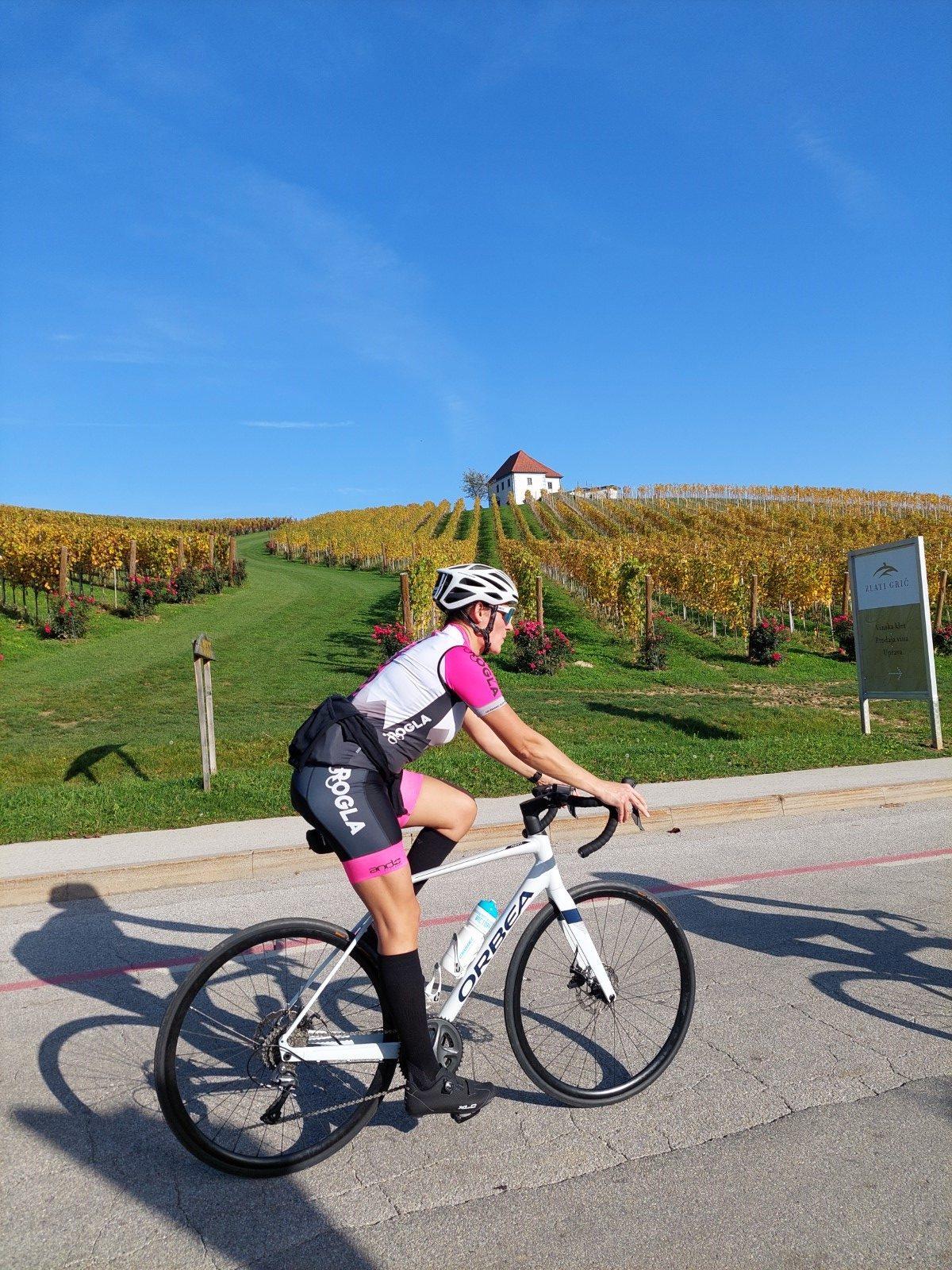
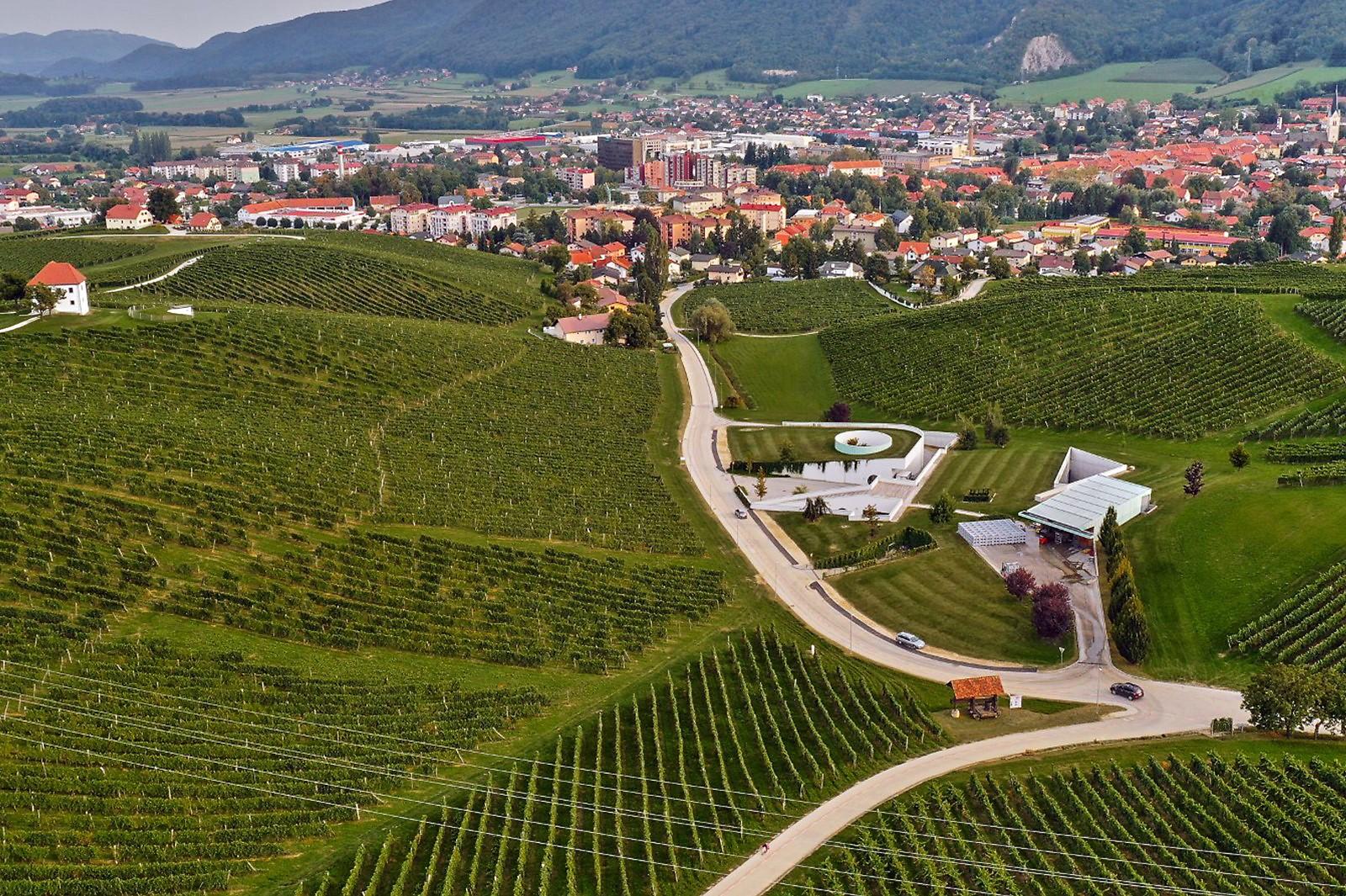
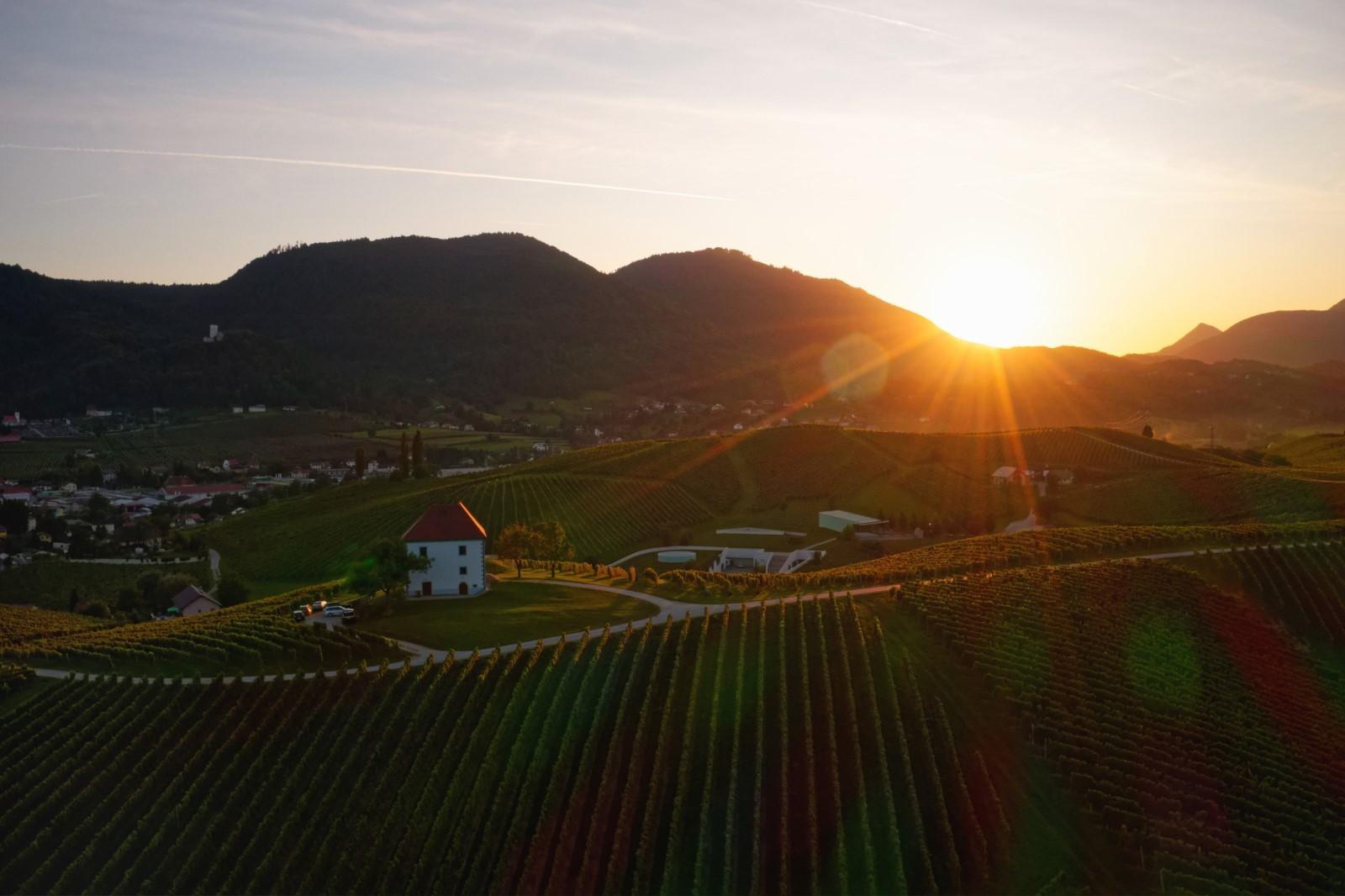
The path to the warm embrace of vines
Starting point: Slovenske Konjice
(Town Square)
Length: 2,77 km
Difficulty: very easy
Surface: asphalt and gravel
The path to the warm embrace of vines
Starting point: Slovenske Konjice
(Town Square)
Length: 2,77 km
Difficulty: very easy
Surface: asphalt and gravel
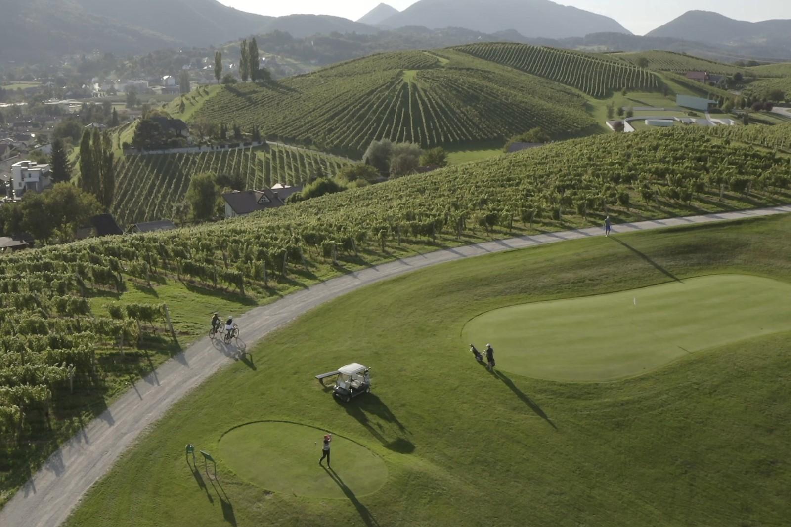
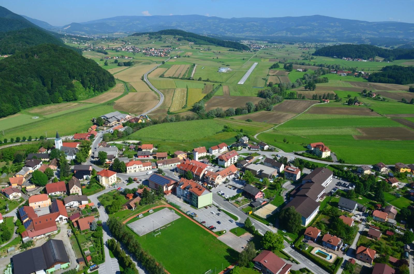
A popular trail offers a stunning vantage point of the Old Square of Slovenske Konjice nestled amidst the vineyards. Map
Route: Mestni trg – Oplotniška ulica – Škalce – Zlati grič (and back)
Description of the route: From the Town Square, proceed towards the Slovenske Konjice Bus Station, then turn right onto Liptovska cesta Street, where you’ll encounter the intriguing Baronvaj Mansion. At the major intersection, make a left towards Oplotnica, and then another left onto Vinogradna ulica Street. As you ascend the hill towards Škalce, the road will transition into a gravel path. Along the way, you’ll pass by the Zlati Grič golf course and the Vineyard Mansion, offering a picturesque view of Slovenske Konjice, before descending to the Zlati Grič Wine Cellar, renowned for its modern facilities.
Additionally, visitors can rent electric or mountain bikes at TIC Slovenske Konjice. Price list.
Simple cycling route to Žička kartuzija
Starting point: Old market centre of Slovenske Konjice
Length: 25 km (both ways)
Total ascent: 131 m
Time: 2 hours (both ways)
Difficulty: medium
Surface: asphalt
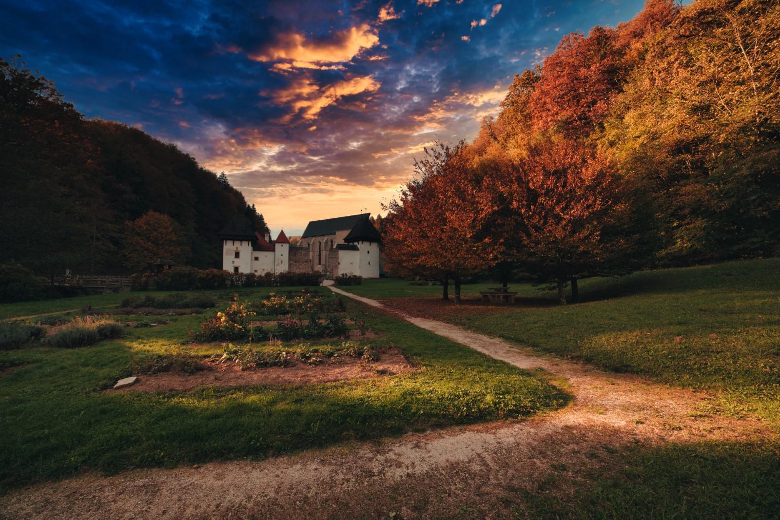
The Carthusians were known for their silent lifestyle, so the serene beauty of the monastery still welcomes visitors who arrive without cars and minimize noise. Follow the picturesque cycling path that guides you to the magnificent Žička kartuzija Monastery.
Course: regional road Slovenske Konjice – Konjiška vas – Žiče – Špitalič – Žička kartuzija
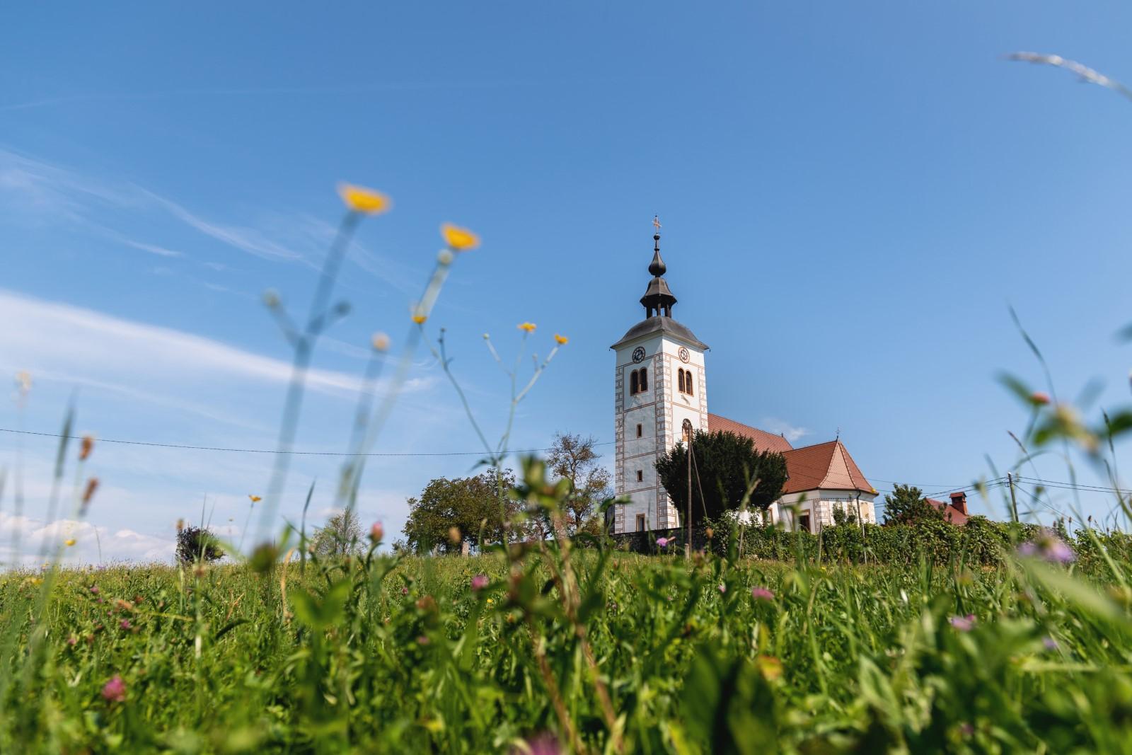
Description of the route: From the town centre of Slovenske Konjice, cycle at the base of Konjiška gora Mountain passing through Konjiška Vas and Žiče. Take a right turn and head directly towards the opposite side of the mountain. Soon, you’ll pass the Žiče quarry, home to the endemic and beautiful Žiče Grobeljnik, a tiny yellow plant. Continuing through the villages of Škedenj and Špitalič, you’ll enter the narrow and tranquil Valley of St. John the Baptist, where a breathtaking historical monument awaits: Žička kartuzija Monastery. Adjacent to it you’ll find Gastuž, Slovenia’s oldest operating inn dating back to 1467.
Consider renting electric or mountain bikes at TIC Slovenske Konjice for added convenience. Price list.
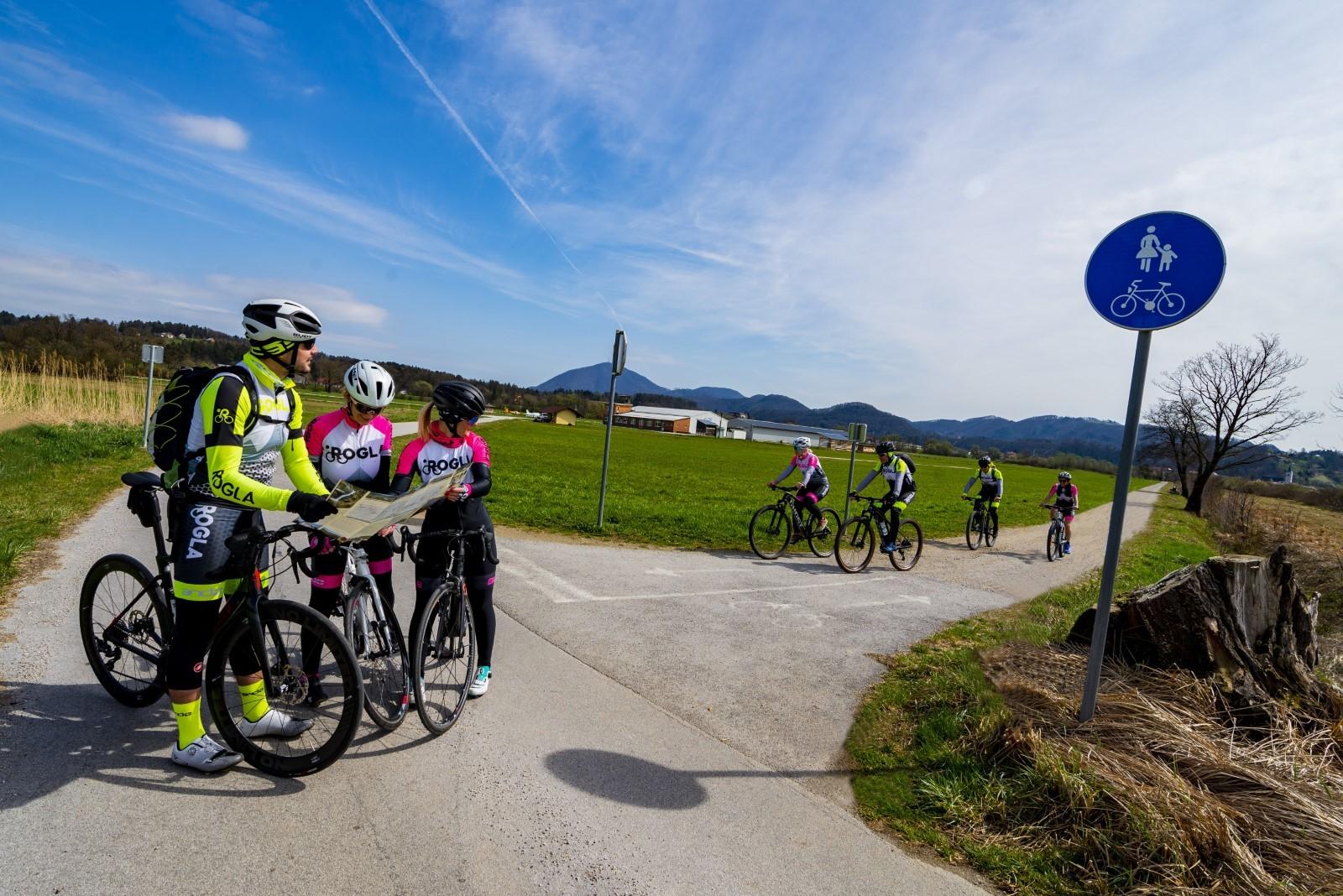
Popular track along the routes of the former Poljčane-Slovenske Konjice-Zreče narrow gauge railway
Starting point: Slovenske Konjice
Length: 20 km
Riding time: 1.5 hours
Difficulty: very easy surface
Surface: gravel and asphalt
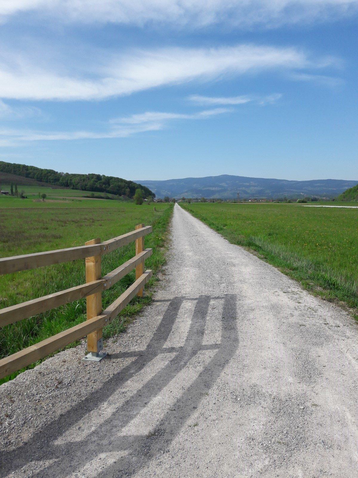
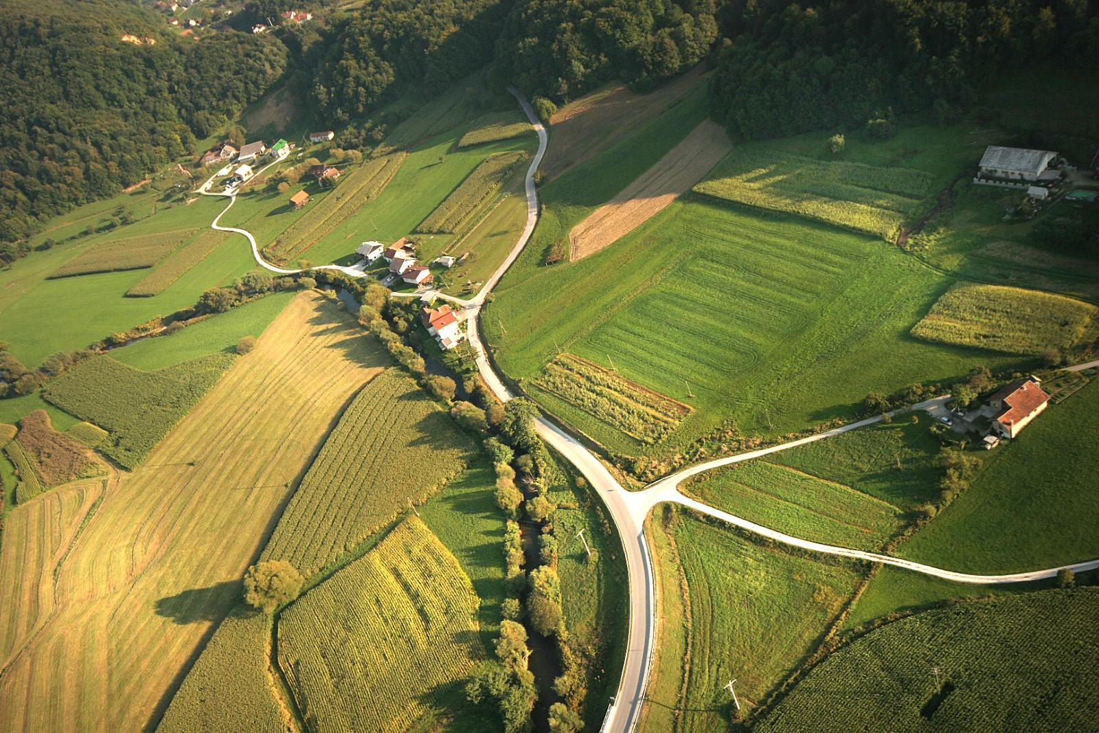
The marked, two-way cycle path is pleasantly easy to ride. It follows the route of the former Poljčane–Zreče narrow gauge railway, affectionately dubbed by locals as ‘Stara štrekna’ (the old railway track). This well-maintained path, measuring between 2-2.5 meters in width, guides you through the regulated section of the Dravinja Valley, winding across fields and meadows. Along the way, you’ll encounter numerous picturesque spots that practically beg you to pause for a photo.
Route: Slovenske Konjice – Draža Vas – Senožet – Loče (and back)
Description of the route: From the Town Square in Slovenske Konjice, head towards the post office and the Konus office building. At the next intersection, turn right, cross the bridge over the Dravinja River, and continue straight on Delavska cesta Street. As you reach a larger road bypass, make a left turn, cross the bridge once more, and then immediately turn right onto a straight road running parallel to the river. At this point, you’ll find yourself on the so-called “Stara štrekna,” the former narrow gauge railway line. From here onwards, the route is marked with red direction signs.
You’ll pass by the Ecological Waste Management Center, where the road transitions into a well-maintained gravel track, merging with the Prežigal Water Educational Trail. Enjoy a smooth ride on this flat road until you reach the highway, where the road veers to the right. Upon reaching the asphalt road, turn left and proceed through a small tunnel under the highway. Continue along the tarmac road parallel to the highway. This path will guide you to Draža Vas and the regional road, where you’ll make a right turn.
After crossing the bridge over the Dravinja River, turn left and follow the gravel path towards the airport located on the right side of the Dravinja. Upon reaching the airport, head towards the regional road, then turn left after about 150 meters onto the gravel path leading towards Loče. To visit Loče, follow the regional road, or alternatively, return along the same route. Additionally, electric or mountain bikes can be rented at TIC Slovenske Konjice. Price list.
A cycling route that connects Loče with neighboring villages
Starting point: Loče
Length: 20.7 km
Surface: asphalt
A circular cycling route, unmarked yet inviting, guides cyclists through the scenic Dravinja Valley and its undulating slopes, adorned with charming villages and captivating cottages.
Route: Loče – Koble – Draža Vas – Žiče – Klokočovnik – Suhadol – Lipoglav – Loče
A picturesque cycling route that offers views of not one, but two castles
Starting point: Loče
Length: 12.8 km
Surface: asphalt
An unmarked cycling route that ascends from Loče to the surrounding hills with beautiful views of the Dravinja Valley. Along the way, you will see two mighty historical landmarks, the Pogled Manor in Loče and the Zbelovo Castle, which protected the paths along the Dravinja River in the past.
Route: Loče – Koble – Sv. Jernej – Vrh – Zbelovo – Mlače – Pogled – Loče
Cycling trail, where we get to know and experience the municipality of Slovenske Konjice.
Starting point: Slovenske Konjice
Length: 48.6 km
Surface: asphalt and gravel
If you want to explore both the well-known and hidden gems of the municipality of Slovenske Konjice, this cycling route is perfect for you. This unmarked circular path begins in the town of Slovenske Konjice and ascends to Konjiška gora Mountain, then leads through to the Valley of St. John the Baptist, home to the impressive Žička kartuzija Monastery. The route continues through a narrow valley into the Dravinja Valley, reaching Zbelovo, before returning to Slovenske Konjice via the hilly terrain past Tepanje.
Route: Slovenske Konjice – Sojek – Žička kartuzija Monastery – Špitalič – Žiče – Loče – Zbelovo – Sveti Jernej – Spodnje Grušovje – Novo Tepanje – Brdo – Bezina – Slovenske Konjice
You can also rent electric or mountain bikes at TIC Slovenske Konjice. Price list.
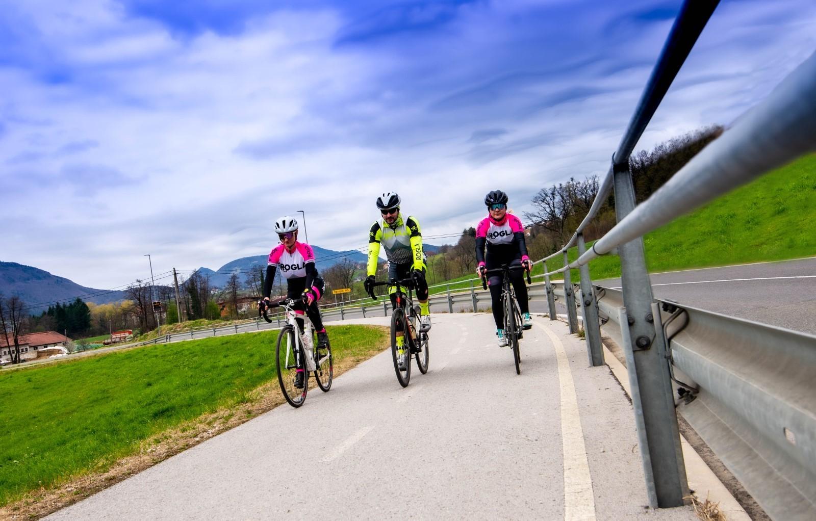
Circular cycling route to Tepanje
Starting point: Slovenske Konjice
Length: 12.8 km
Surface: asphalt
This circular cycling route takes you through the sunny Dravinja Hills, the village of Tepanje, and the pleasant plains along the Dravinja River. The diverse terrain offers a variety of scenic views.
An unmarked circular path ascends from Slovenske Konjice to the village of Gabrovnik and to sunny hilly areas that allow for beautiful photography. After these, you can descend past Tepanjski vrh into the valley, to the developing village of Tepanje. From there, take the official two-way cycling path towards Slovenske Konjice. But not for long, as the cycling route soon leaves the trail and turns left towards the village of Prežigal. After a while, you will cross the Dravinja river and return to Konjice after a level terrain past the lovely villages of Breg and Blato.
An unmarked circular path ascends from Slovenske Konjice to the village of Gabrovnik, offering sunny hilly areas perfect for beautiful photography. From there, you can descend past Tepanjski Vrh into the valley, reaching the developing village of Tepanje. Follow the official two-way cycling path towards Slovenske Konjice, but not for long, as the route soon veers left towards the village of Prežigal. After some time, you’ll cross the Dravinja River and return to Slovenske Konjice along level terrain, passing the charming villages of Breg and Blato.
Route: Slovenske Konjice – Gabrovnik – Brdo – Tepanjski vrh – Tepanje – Prežigal – Breg – Blato – Slovenske Konjice
OR
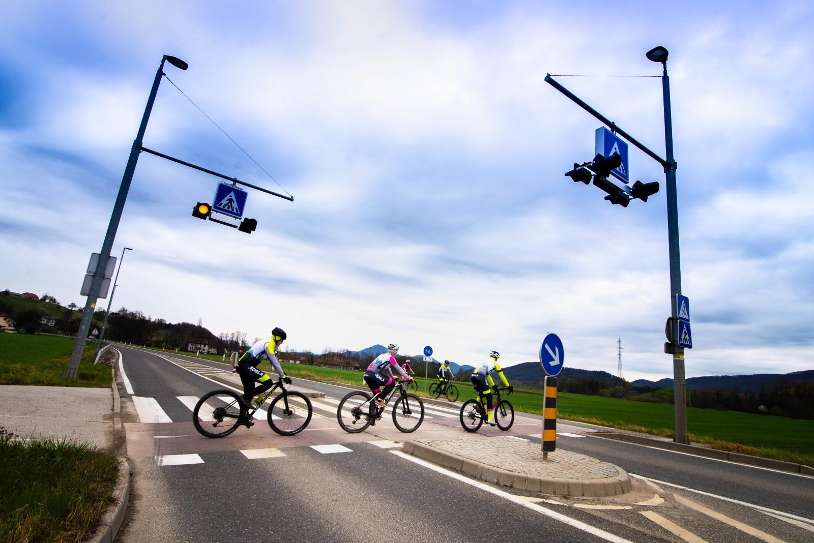
If you just want to visit Tepanje, you can also reach it from Slovenske Konjice via the regional cycling route R29, which follows the Slovenske Konjice–Tepanje route.
A two-way bicycle path has been constructed on this section, starting at the roundabout near the Hofer store at the exit from Slovenske Konjice and ending at the roundabout at the highway entrance. This well-maintained cycle path is just over 3,230 meters long and 2.5 meters wide. You can also rent electric or mountain bikes at TIC Slovenske Konjice. Price list.
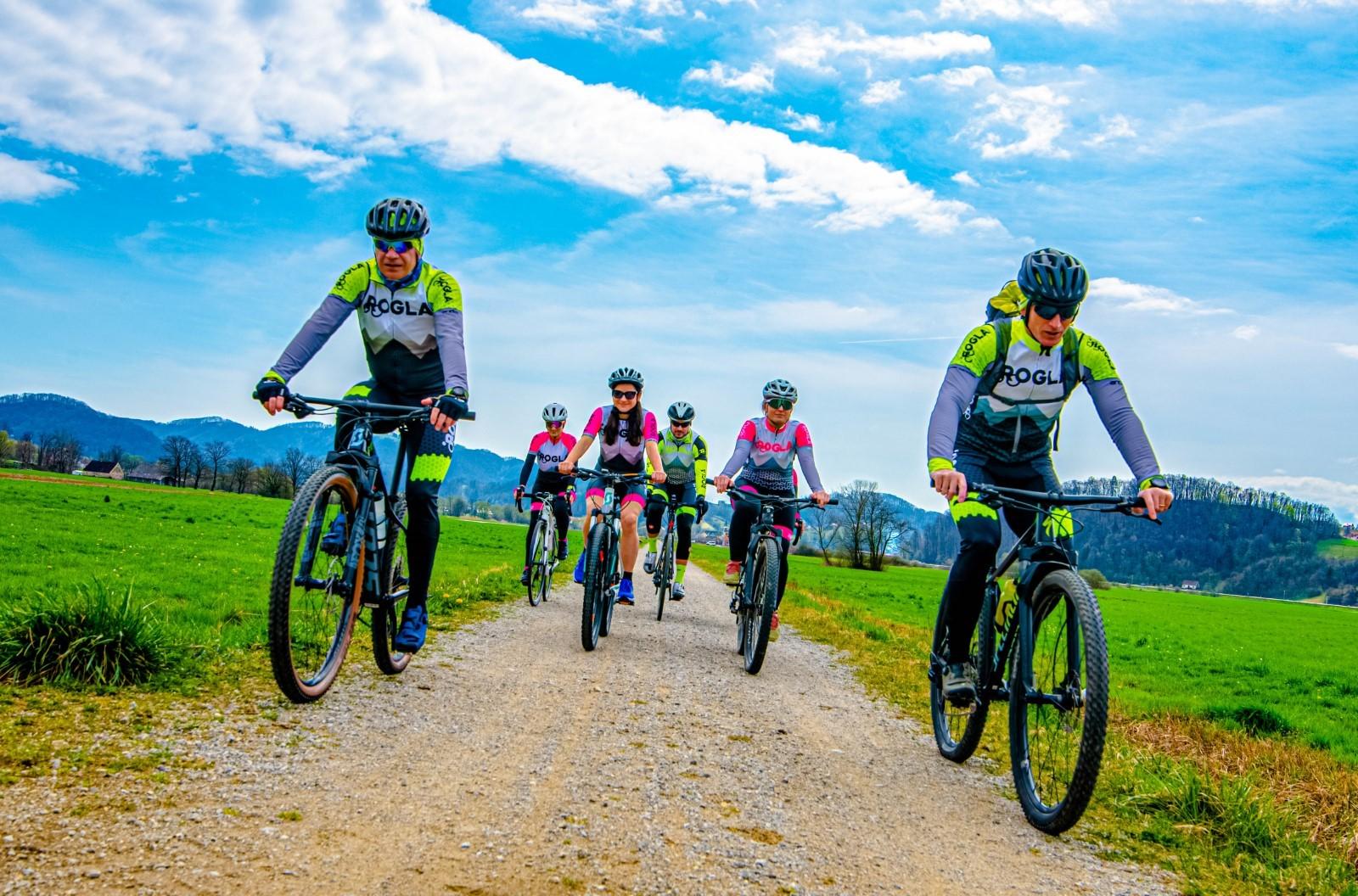
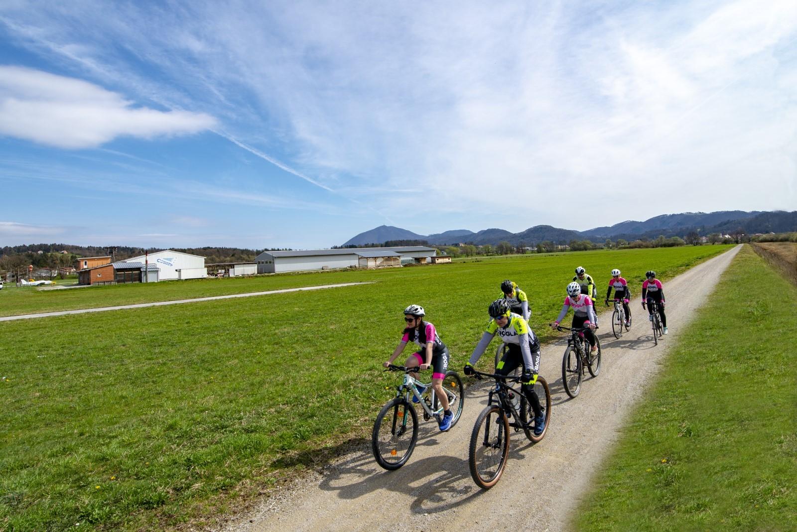
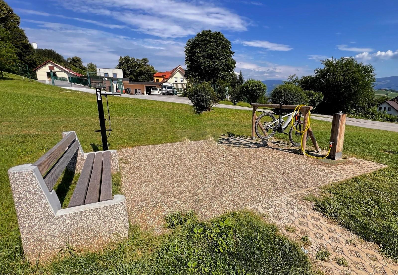
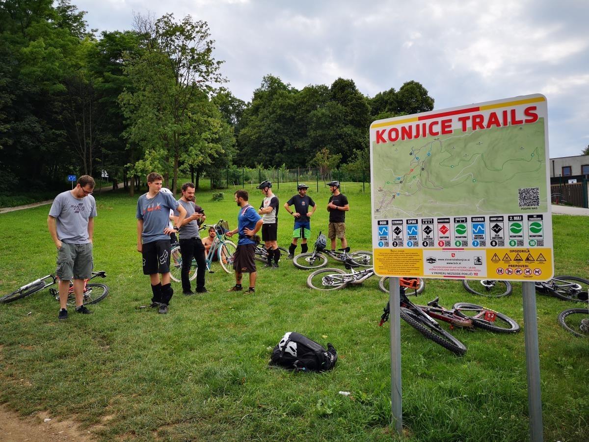
Konjiška gora Mountain offers a variety of cycling routes, ranging from leisurely rides to more adrenaline-fueled adventures.
Starting point: Bike Ranch Nana’s House, Breg pri Konjicah 3, 3210 Slovenske Konjice
Length: 19 km
Numberof routes: 14
Difficulty: medium
Surface: forest paths, gravel, asphalt
Konjiška gora Mountain offers a wide variety of terrains, ensuring that every cyclist can find a suitable route. Even the most demanding adrenaline enthusiasts will find thrilling paths to satisfy their adventurous spirits.
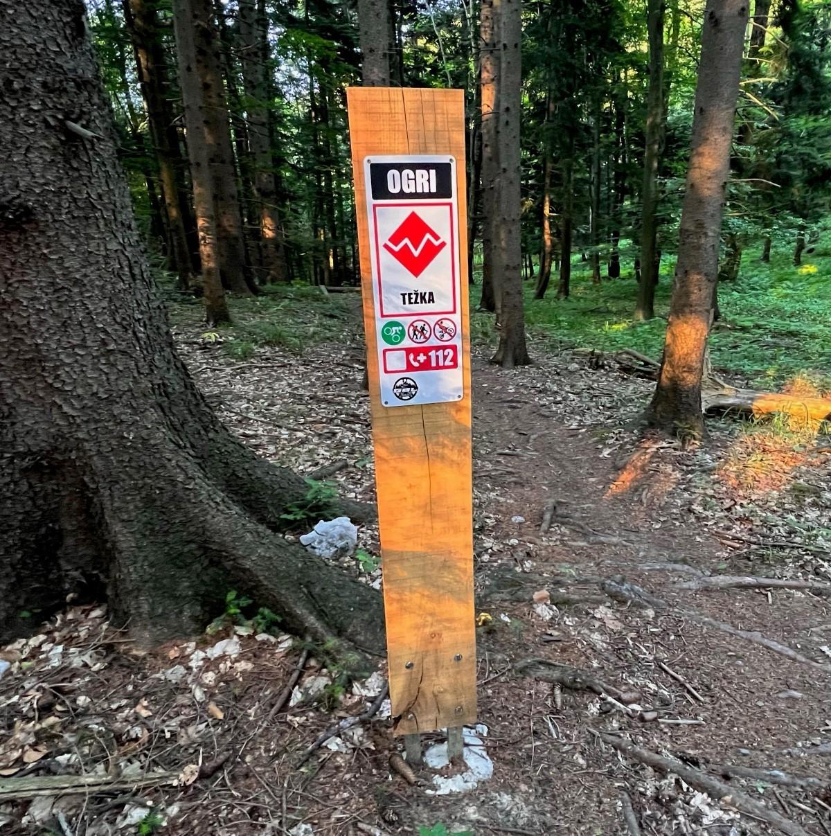
Currently, there are about 5 kilometers of downhill trails at all levels of difficulty in the Konjice Trails cycling park. Due to the interesting structure of the Konjice Mountains, the tracks are not among the easiest, but their creators have made sure that every cyclist can find something which appeals to them. The use of the bike park is free of charge. You can also use a bicycle taxi (bike shuttle), and accommodation for cyclists and equipment has also been taken care of.
In the picturesque Konjice Trails cycling park, nestled within the captivating mountains of Slovenske Konjice, approximately 5 kilometers of diverse downhill trails await enthusiasts of all skill levels. The topography of the region lends itself to exhilarating, albeit challenging, routes, carefully crafted by dedicated trail designers to cater to every cyclist’s preferences and abilities. Embracing inclusivity, access to the bike park is completely free of charge, ensuring that adventure-seekers of all backgrounds can indulge in the thrill of mountain biking. For added convenience, a bicycle taxi service, also known as a bike shuttle, is available, facilitating easy transportation to and from the trails. Furthermore, the cycling park offers comfortable accommodation options tailored specifically for cyclists, along with provisions for securely storing equipment, ensuring a seamless and enjoyable experience.
Bike Center Konjice – BCK
3210 Slovenske Konjice
T: +386 (0)69 799 923
M: +386 (0)51 444 141
E: info@bck.si
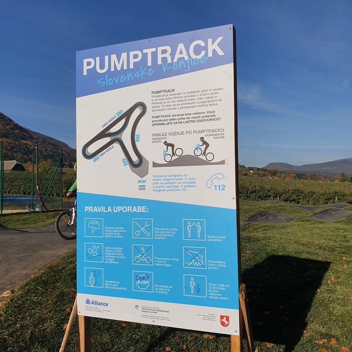
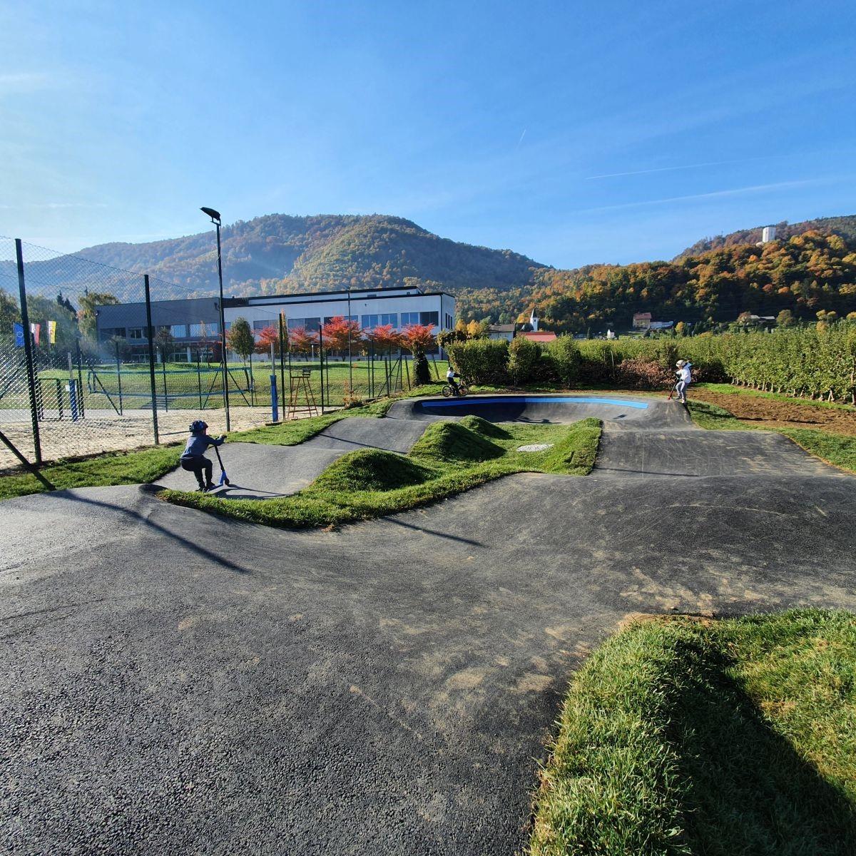
A polygon for cycling, skateboarding, rollerblading and scooter enthusiasts
Type: standard
Year built: 2021
Area: 860 m2
Asphalt area: 440 m2
For diverse sports enthusiasts, the Slovenske Konjice Sports Hall features a polygon characterized by undulating bumps and interconnected bends, forming a rhythmic circular loop. Primarily frequented by cyclists, it also provides a suitable terrain for skateboarding, roller skating, and scooter riding.
The renowned pump track is a robust earthen course that captivates even the youngest riders as they navigate their initial turns on a bike. Seasoned cyclists, on the other hand, find themselves irresistibly drawn to its undulating terrain. Negotiating the track requires no pedaling or pushing; instead, riders rely solely on shifting their body’s center of gravity.


